30 Organizing Places
You know where you live, the location of your school, and the locations of many other places. All of these places are organized using many overlapping organizing systems that use a variety of organizing principles.
In this chapter you’ll learn about some of these organizing systems and that will make it easier to find places where you want to go. But more importantly, understanding how places are organized will also help you better understand history, government, and other subjects that often have geography as an important influence.
-
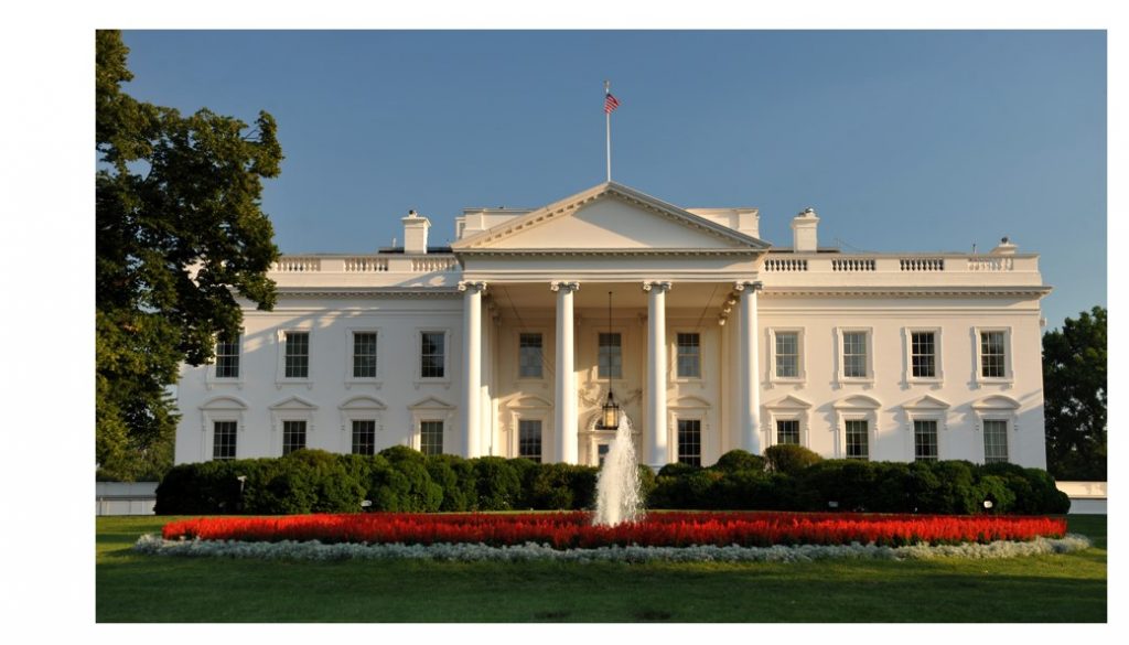
1600 Pennsylvania Avenue
-
In Washington, D.C.
-
In the United States
-
On the planet called Earth
The places we live are organized… our neighborhood, our city, our state, our country, our planet. And at an even larger scale, our planet Earth is organized as one of the members of the category we call “planets in our solar system.”
These contexts use different organizing systems because they have answered the WHAT, WHY, and HOW questions in ways that make sense for the size of the place being organized.
Organizing the Earth
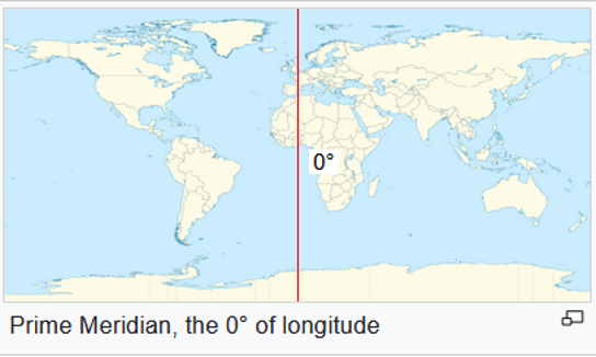
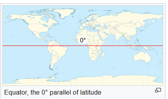
When we talk about our planet Earth, we most often describe it as consisting as seven continents (Asia, Europe, Africa, North and South America, Antarctica, and Oceania) whose boundaries are created by natural aspects of geography (oceans, seas, and mountains). This natural organization isn’t precise enough to identify places, so the system of LONGITUDE AND LATITUDE was invented to enable any place on Earth to be identified using coordinates expressed in degrees. The Longitude coordinate measures the distance east or west of the Prime Meridian in Greenwich, England, and the Latitude coordinate measures the distance north or south of the Equator.
The White House is located at 38.90 degrees N latitude and 77.04 degrees W longitude.
Organizing Countries
A country is a nation with its own government and land territory. There are 195 countries in the world today. The continent of Africa has 54 countries, followed by Asia with 48 and Europe with 44. Countries vary a lot in size; Russia is the largest country, with over 6 million square miles of land, which is about 11% of all the land on earth. Canada, China, and the United States are the next largest. The smallest countries are mostly islands, and some have fewer than 100 square miles of land (that’s equal to a square 10 miles on each side, so small that you could walk or bike across the whole country in just a few hours).
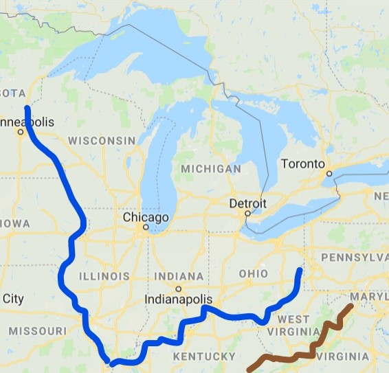
The size and borders of a country are strongly influenced by geographical features, especially mountains, deserts, and bodies of water (oceans, seas, lakes, and rivers) that separate the places that people live from each other. This separation enabled nations to evolve their historical identities with their own language and culture. You can see in the map how rivers (blue lines) and mountains (brown line) shape many of the borders between many of the United States, and how the Great Lakes create the border here between the United States and Canada.
Organizing Cities
Cities contain many different types of organizing systems that together enable the people who live, work, or visit there to do so safely and efficiently. Many cities are divided into parts or “zoned” for different purposes. There are housing areas, recreational areas like parks, commercial areas for shopping, offices, factories, and warehouses, and governmental areas where the people who run the city work.
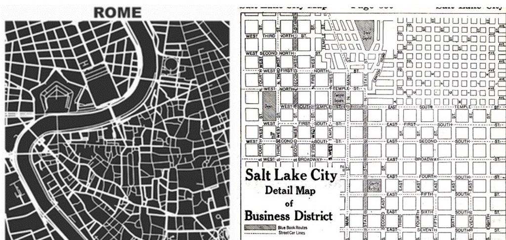
Some cities are very old, like Rome Italy, which was first settled about 2800 years ago. The map of Rome reveals a very irregular pattern of streets that evolved as the city grew across the river that snakes through the city. Other cities, even some very old ones, were planned very carefully, with streets organized in a very regular pattern. Just as latitude and longitude coordinates make it easy to locate any place on earth, a “GRID” city plan imposes a very regular system of streets (like that of Salt Lake City here).
Many big cities are sub-divided into smaller regions for to make government functions more closely tied to people. These smaller regions are typically called boroughs, districts, wards, or precincts. But no matter how a city is “officially” organized, over time cities organize themselves into neighborhoods that differ in the typical ages, wealth, and lifestyles of the people who live in them. Neighborhood boundaries are not official ones, but because neighborhood names are commonly used by people to identify nice and safe (or not nice and not safe) places to live and go out, after you’ve lived somewhere for a while you will be familiar with neighborhood names.
Cities like Salt Lake City that were carefully planned often name their streets with numbers or letters to reinforce the idea of a grid with equally spaced city blocks. But just as the names of people can suggest their occupations, ancestry, appearance, or other categories they belong to now or in the past, it is interesting to study the names of streets that are named after people because of what they can tell us.
Street names are like history books that tell us about the cultural and social values of the city over time. Which people were honored by having streets named after them? Were they scientists, artists, military heroes, politicians, or religious leaders? Were they mostly men or mostly women? Were they honored for personal achievements (making an important invention, setting a world record in sports), or were they honored for their entire life’s work?
